
One of the most common questions I get asked when teaching workshops or discussing photography is, “How do you know when to go out and shoot?” Or, “What do you look for in the weather forecast when planning a shoot?”. You might look our the window in the morning an hour before sunrise and see clear skies and stars and decide to sleep in, but then when you wake up you see clouds in the sky and wished you had headed out. Or, 7:00pm rolls around and it is still raining so you decide not to go out and head to the bar instead to get dry and warm, but when sunset time rolls around the clouds break and you sit and watch some of the most dramatic color form in the sky that you have ever seen. We have all been there, right? Well, one doesn’t need a masters in meteorology to figure out whether or not to head out, and hopefully I can clear some things up and help make it easier for you to make that decision the next time you are considering heading out with your camera.
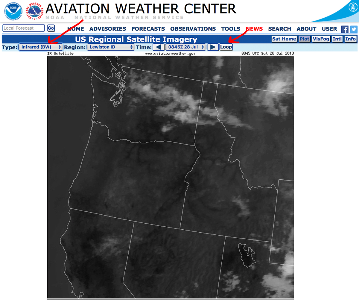
First of all, we need to have a few good sources of information other than just looking out the window. The best case scenario is that you have access to wifi where you will be, and second best is that you have had recent access so it is possible to do some advanced preparation. For me, the most valuable immediate source of information is access to “visible” and “infrared” satellite radar loop. The loop is important because this is how you know which direction the clouds are moving. You will use the visible satellite for daylight hours, and the infrared when the light is low or it is completely dark. For the USA, my favorite place to look for this is aviationweather.gov Here you can find both visible and infrared satellite for the entire USA and each individual state or region when clicking down below. (I have found similar sources for many of the different places around the world that I have photographed just by googling “satellite radar” and the name of the country.)
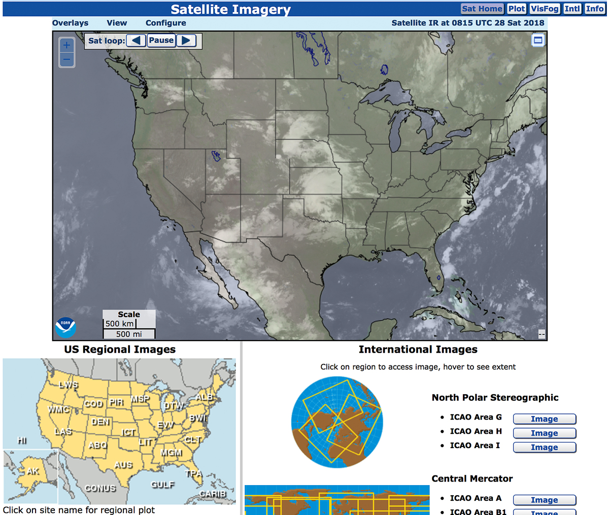
You can select “loop” and either “visible” or “infrared”.
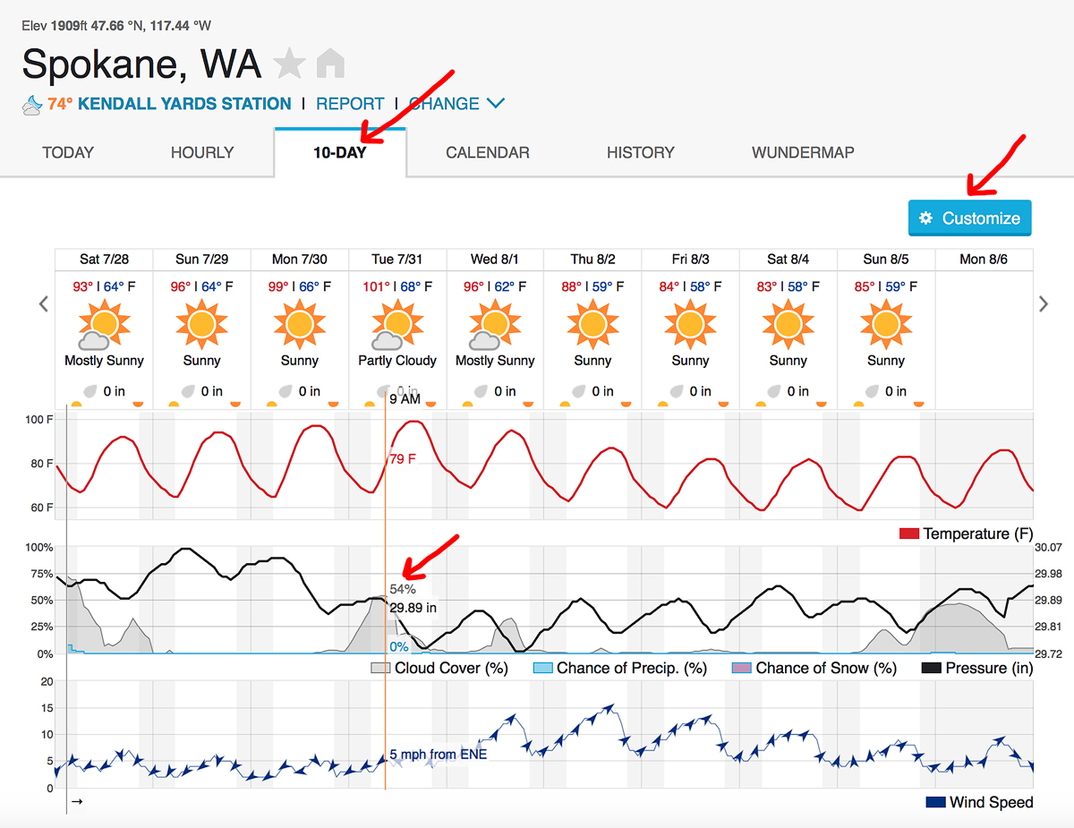
The second most valuable source of information is the weather forecast. This one is pretty obvious but there is one specific thing I look for in a good weather forecast that I find extra useful. This is the percent of cloud cover spread throughout the day. One of my favorite sources for this is wunderground.com First, select the 10-day forecast. Next, by selecting “cloud cover” under “customize” you can hover over each day and see the percentage of cloud cover for each specific time throughout the day.
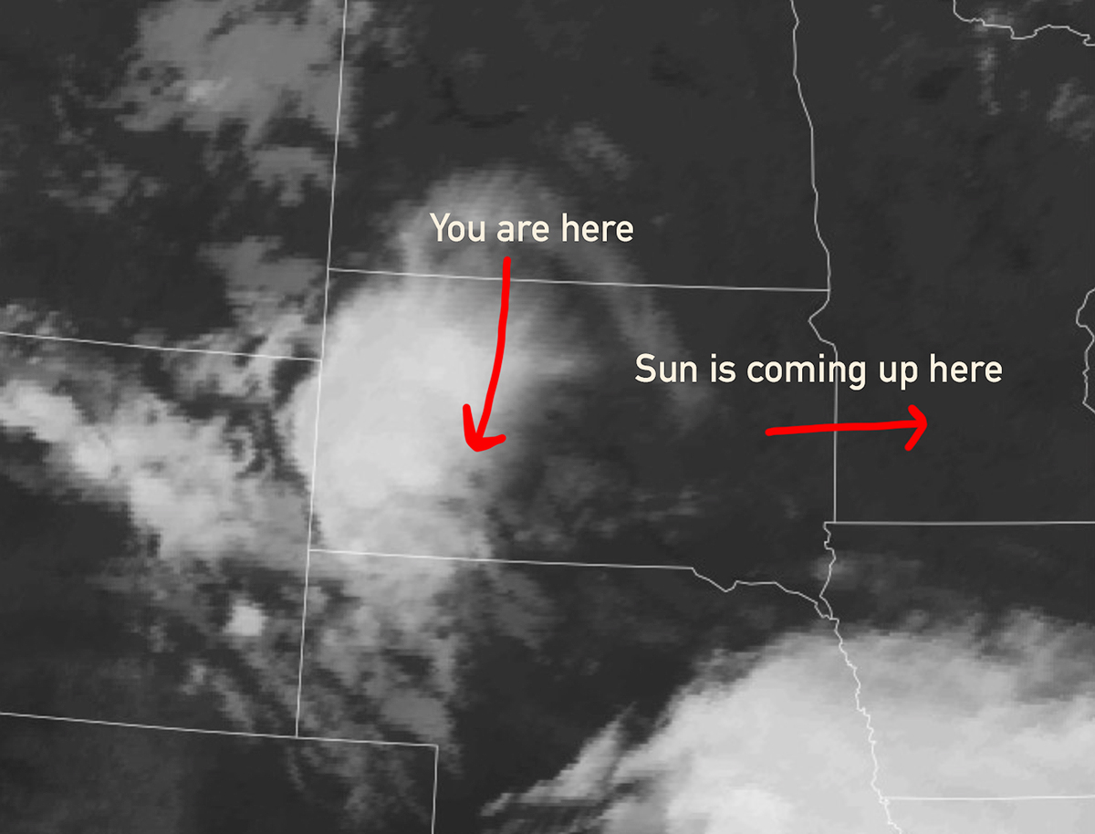
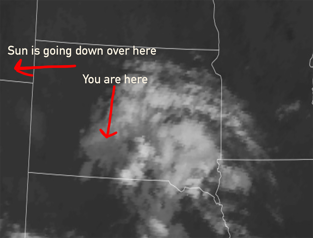
Now lets talk about what these sources tell us and how they are useful. Seeing the cloud cover above us and the direction that it is moving in combination with the percentage throughout the day can provide some very valuable information that we just can’t get from a basic weather forecast alone. Let’s say that forecast calls for rain and clouds. Many people might see this and decide to stay in or not wake up to shoot. When I see this I get a bit excited and do some further research. First, I will look at the cloud cover graph and see if the clouds are increasing or decreasing. If I see that the cloud cover is increasing just before a sunrise shoot, that is usually a good sign, and if I see that the cloud cover is decreasing just before a sunset shoot that usually means it is a good time to go out as well. Next is where the satellite radar comes in. When it comes close to time to head out, I will check out the radar. For dramatic skies at sunrise, I look for incoming clouds from the west, and for dramatic sunsets, I look for clouds exiting the area and heading east just before dusk.
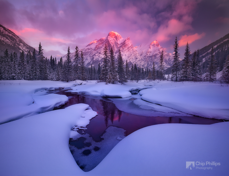
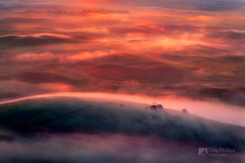
Here is an example of a sunrise situation that would almost guarantee dramatic light.
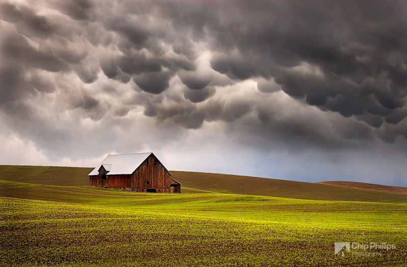
Here is an example of a sunset situation that would almost guarantee good light.
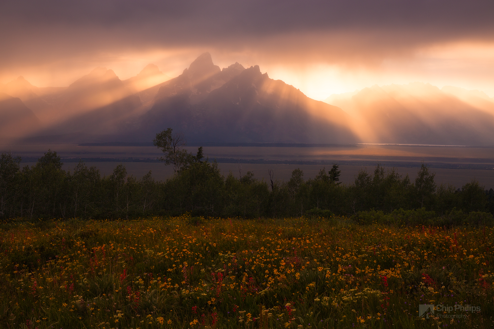
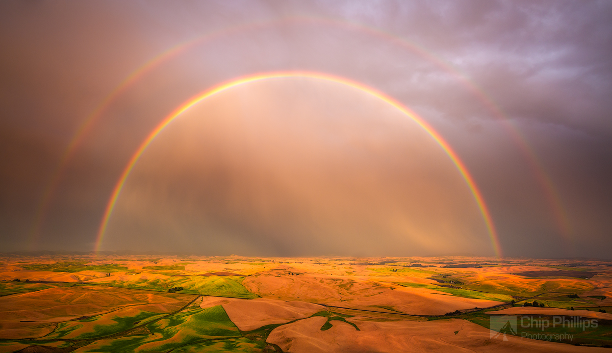
You can narrow down your chances even more by taking the cloud height into consideration. If the clouds are really high, you can be pretty far into them and still have some extremely dramatic light. In fact, I have witnessed some of the most amazing skies of my life over 150 miles underneath clouds that covered almost the entire state of Washington west of the Cascades. If the cloud cover is low, your best bet is to be close to the edge. Often times it is these types of situations where I get great dappled light, sun rays, and rainbows.
Another thing I look for in the weather forecast is thunderstorms. If storms are in the forecast and the cloud cover percentage is near 50 percent, this is a good time to go hunting for some dramatic shots. Just make sure you are safe and don’t go out when lighting is striking nearby!
Fog in the forecast can make for some great atmospheric shots and is something I look for in the weather forecast all the time. Lots of times it will say fog, especially at sunrise, but another thing to look at is the dew point. When the dew point and temperature are the same, there is a good chance for some foggy atmosphere.
Its amazing how much knowing a little bit of meteorology can help your photography and improve your chances for getting good shots. I hope you have learned something here today and happy shooting.

Location: Spokane, Washington
Website: www.chipphillipsphotography.com
Instagram: www.instagram.com/chipphillipsphoto
Facebook: www.facebook.com/chipphillipsphoto
Chip Phillips began his relationship with photography in 2006 when his father gave him his old Pentax Spotmatic film SLR camera. Chip was immediately hooked and soon made the transition to digital. Given his lifelong love of the outdoors, he naturally made the progression to focusing on landscape photography. A professionally trained classical musician, Chip also performs as Principal Clarinet with the Spokane Symphony Orchestra, and is Adjunct Professor of Clarinet at Gonzaga University. Chip resides in Spokane Washington with his wife and son.
Recent Comments